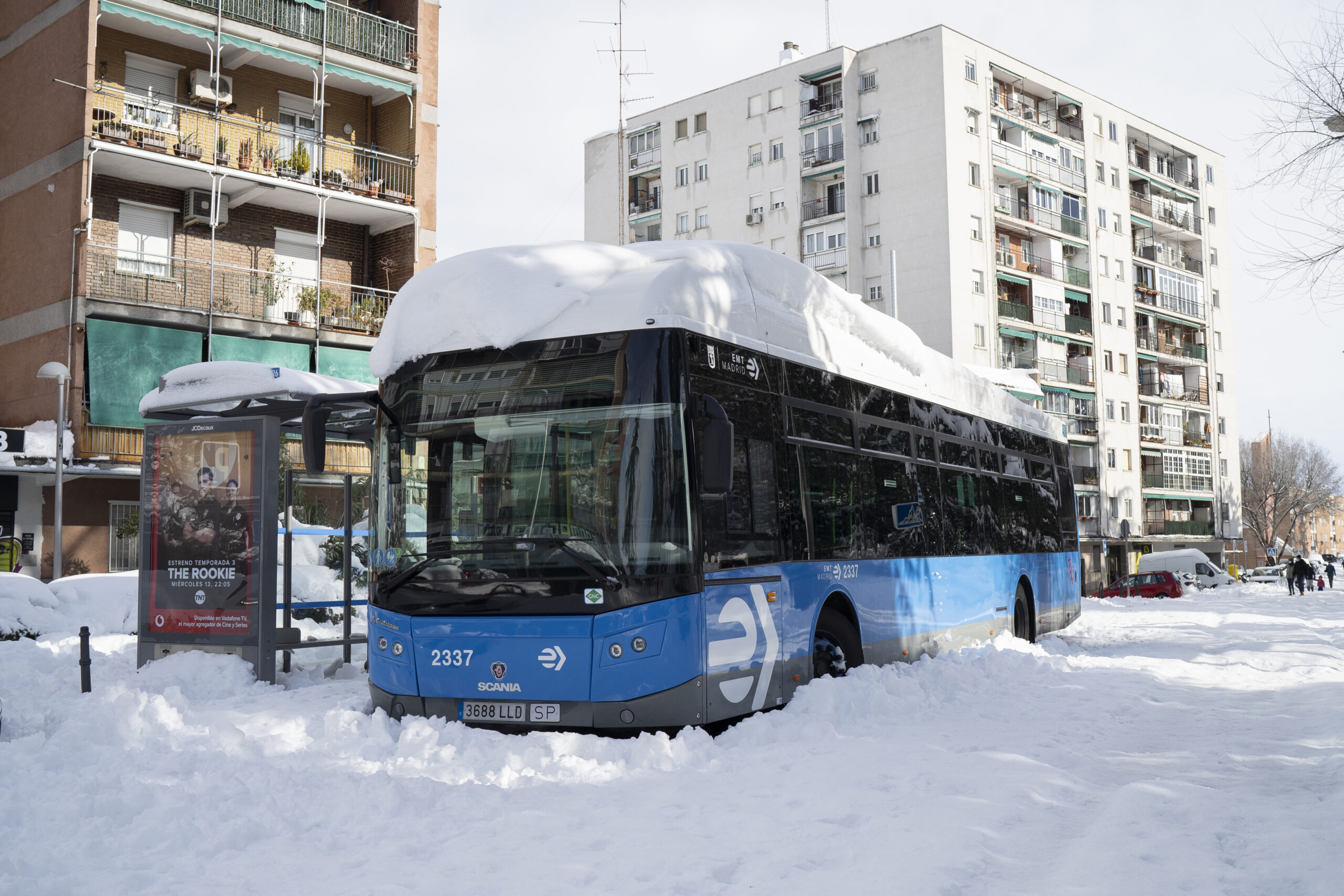
Sudden freezing cold isn’t the kind of extreme weather usually associated with climate change.
But global warming is thought to be behind extreme cold snaps, especially in places that don’t usually experience them. Here’s why.
How does climate change cause extreme cold weather?
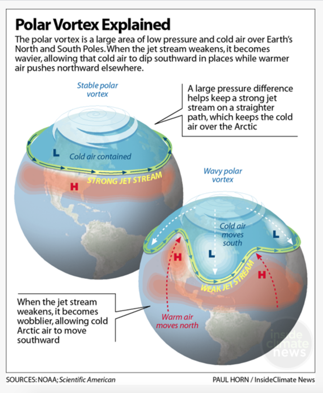
Normally, the northern hemisphere’s coldest air is trapped in the Arctic. Milder and warmer air is found further south. It is this temperature difference (and associated atmospheric pressures) between the north and the south which determines the strength of the jet stream.
The jet stream (so called because it was discovered by pilots during World War II) is a powerful band of wind, high in the atmosphere. The jet stream shapes the Northern Hemisphere’s weather, along with the Atlantic Ocean’s Gulf Stream currents. The Gulf Stream gets the main credit for making our UK winters generally milder and wetter than other parts of northern Europe.
Melting Arctic ice from rising global temperatures is causing what some scientists are cutely calling a ‘cold blob’ in the North Atlantic Ocean, weakening the jet stream and Gulf Stream. This in turn is impacting the polar vortex, meaning colder weather further south than usual.
How a warming Arctic impacts the Gulf Stream
The cold patch from a melting Arctic has messed with the Atlantic Ocean currents that underpin the Gulf Stream – also known as the AMOC, or Atlantic Meridional Overturning Circulation. Research shows that it’s weaker than it’s been over 1000 years.
In the past 30 years, the Arctic has warmed about twice as fast as the rest of the world, a phenomenon known as ‘Arctic amplification’. Scientists believe that with less bright white sea ice to reflect away the sun’s rays, the Arctic is getting warmer – and faster than the rest of the planet.
Warmer Arctic air has shrunk glaciers and melted away a significant amount of sea ice. This has led to the ‘cold blob’ – a patch of the North Atlantic ocean southeast of Greenland where glacier meltwater is cooling the ocean.
The polar vortex
The polar vortex is a giant swirling ring of low pressure and cold air, and one surrounds each of the Earth’s poles, that keeps cold air trapped there. It’s at least 16km above the Earth’s surface. It’s too high to directly affect our weather, but it does have an indirect impact.
A strong jet stream will keep the cold air – and weather – contained in the north. A weak jet stream will develop deep ‘meanders’, which will draw cold Arctic air southwards. An unstable polar vortex is thought to be behind the jet stream weakening. The polar vortex is always around the pole, but it weakens in summer and strengthens in winter. When it’s rotating nicely, all that cold air stays in the vortex, as pictured below.
Scientists think it’s possible that a warmer Arctic could be making the polar vortex more prone to wobbling or waving, pushing colder Arctic weather south.
How global warming could permanently alter the UK’s climate – making it much colder
There is increasing evidence that these jet stream meanderings could become permanent. Scientists think that the Gulf Stream system might slow to the point of no return and effectively collapse, or switch off.
This would permanently alter the climate on both sides of the Atlantic – making it a key climate tipping point.
That’s why sudden bitterly cold weather is actually further evidence of global warming. And while scientists disagree on how quickly the Gulf Stream could collapse, the only way to avoid the UK plunging into a permanent deep freeze is to stop climate change.